Digital Orthophotography
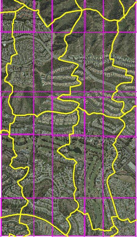
 Digital orthophotography is computerized aerial/satellite imagery, corrected through a digital imaging process that places all ground features in their true map positions along an earth-referenced coordinate system. When loaded into CAD & GIS software systems, digital orthophotography can be used to make accurate measurements and as a background over which other positional data can be layered. Digital orthophotography is an especially valuable tool as it provides a great deal of information with a visual impact, a veritable snapshot in time.
The orthorectification processes are performed using photogrammetric software on GPSi’s high powered digital workstations. Radiometric adjustments are performed to balance and match color tones, brightness and contrast of the imagery over the whole project. Image editing software is used to repair any minor flaws on the imagery. Unsightly distortions at bridges and overpasses are corrected, and we provide a final orthophoto output in .TIF image with an accompanying world header file (.TFW) format. A plethora of other formats, such as compressed image in MrSid, .ECW, JPEG2000, are available upon request. We also offer:
- Custom Digital Orthophotography [PAN/RGB/CIR/4-Band]
- Historical Orthophotography
- Citywide Orthophotography
- Compression/Conversion of Existing Orthoimagery
- Printing and Mounting Services