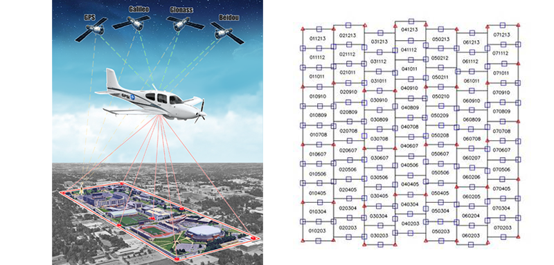
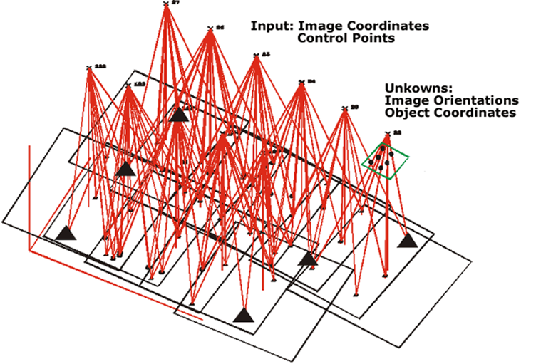
Digital Analytical AeroTriangulation (DAAT)
 This encompasses scanning of aerial film; digital image compression services; and production of a wide variety of aerial image products such as photo mosaics, photo index layouts, and contact prints that are reproduced on photo paper. Archive quality, mylar, mounting and lamination options are also available.
Our digital files are delivered either on CD/DVD/portable hard drives or via online FTP transfer.
For conventional film based projects, GPSi performs direct scanning of the aerial negatives in preparation for digital aerotriangulation, map compilation, and image rectification. We use the most sophisticated precision photogrammetric roll fed scanner (DSW-700) capable of resolutions of 12microns (2117 dpi) with ½-micron accuracy. Our high quality digital imagery is stored in a secure environment on a 30-terrabyte RAID Level 5 data storage system.
We utilize high end image enhancement software to optimize each image, balancing color tones, and localized bright and dark patches to ensure even, consistent looking imagery of the highest possible quality for photogrammetric tasks.